Online or onsite, instructor-led live Pix4D training courses demonstrate through interactive hands-on practice how to analyze image data and create 3D models with Pix4D.
Pix4D training is available as "online live training" or "onsite live training". Online live training (aka "remote live training") is carried out by way of an interactive, remote desktop. Manila onsite live Pix4D trainings can be carried out locally on customer premises or in NobleProg corporate training centers.
NobleProg -- Your Local Training Provider
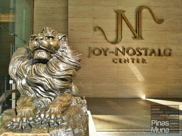
Joy Nostalg
ADB Avenue, Pasig, Philippines
Modern, conducive and equipped for our training courses
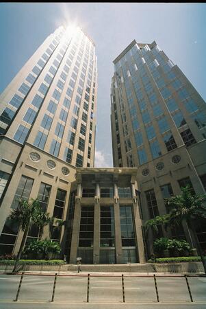
Manila Enterprise Makati
28th Floor, Tower 2, The Enterprise Centre, Manila, Philippines, 1226
Manila's Enterprise Makati Centre is at the heart of the business and finance district in one of the most popular commercial buildings in Makati City. This business centre overlooks the skyscrapers of Makati and from the board rooms there are stunning views of the historic Manila Bay. Described as 'The Business Building Designed for Building Business', it is in a neo-classical landmark twin tower building with magnificently designed facilities, a range of retail and leisure facilities and seven levels of underground parking accommodating 1,200 vehicles. Makati is the country's undisputed financial centre and commercial hub and is home to the headquarters of the 40 per cent of the top 1,000 multinational and local corporations. The city has the most developed telecommunications infrastructure in the country. Transport links are excellent and the Ninoy Aquino International Airport is just five kilometres away.
Pix4D Matic and Pix4D Survey are advanced photogrammetry and geospatial data tools used for high-accuracy mapping, terrain modeling, and analysis.
This instructor-led, live training (online or onsite) is aimed at beginner-level to intermediate-level geospatial professionals who wish to process, analyze, and extract actionable information from drone data using Pix4D Matic and Pix4D Survey.
By the end of this training, participants will be able to:
Process large-scale photogrammetry projects using Pix4D Matic.
Generate orthophotos, digital terrain models, and contour lines.
Use Pix4D Survey to clean and vectorize point cloud data.
Extract and export relevant geospatial deliverables for geological or civil analysis.
Format of the Course
Interactive lecture and discussion.
Hands-on processing using real-world datasets.
Guided project work and interpretation of outputs.
Course Customization Options
To request a customized training for this course, please contact us to arrange.
This instructor-led, live training in Manila (online or onsite) is aimed at field ecologists and conservation managers who wish to post-process Pix4D drone data.
By the end of this training, participants will be able to:
Implement Google Earth to enhance UAV mapping .
Use outputs of images to generate reports.
Post-process with GIS and CAD software for advanced drone data modeling.
This instructor-led, live training in Manila (online or onsite) is aimed at field ecologists and conservation managers who wish to land survey and drone map with Pix4D.
By the end of this training, participants will be able to:
Use end to end drone mapping processes and techniques.
Achieve high surveying accuracy.
Understand the fundamentals of global coordinate systems and GPS.
Generate and analyze survey output with Pix4D's image processing software.
Online Pix4D training in Manila, Pix4D training courses in Manila, Weekend Pix4D courses in Manila, Evening Pix4D training in Manila, Pix4D instructor-led in Manila, Pix4D one on one training in Manila, Evening Pix4D courses in Manila, Pix4D classes in Manila, Pix4D private courses in Manila, Pix4D instructor in Manila, Online Pix4D training in Manila, Pix4D instructor-led in Manila, Pix4D coaching in Manila, Pix4D trainer in Manila, Weekend Pix4D training in Manila, Pix4D on-site in Manila, Pix4D boot camp in Manila